How does the technology work?
Two main technologies are used to monitor the location of people within the criminal justice system: radio-frequency (RF) or GPS.
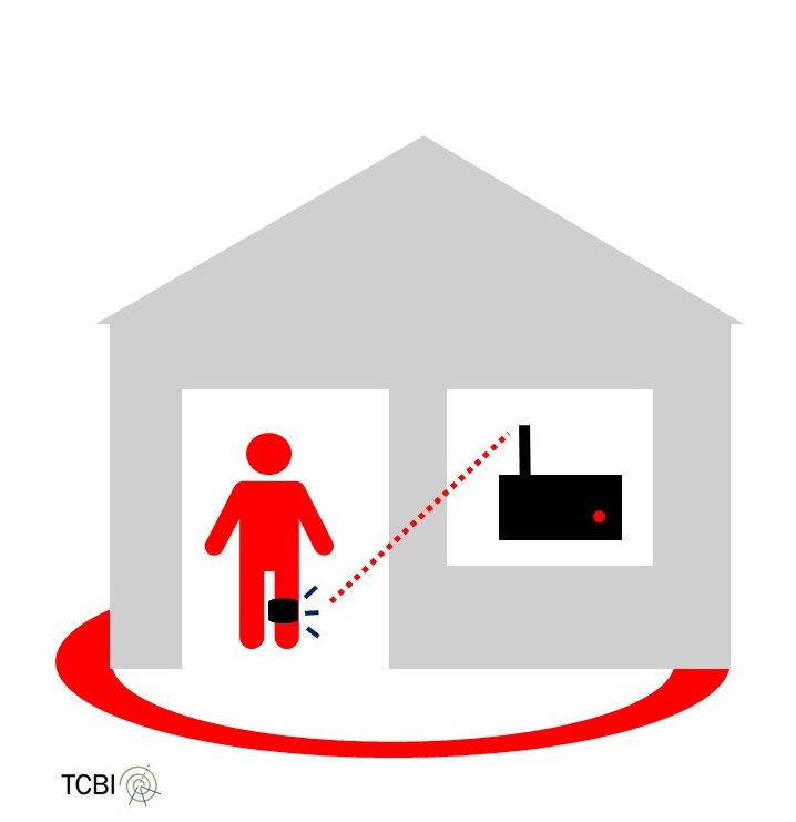
RF monitoring
RF technologies are used to monitor whether individuals’ stay within a particular indoor location, usually their home, place of work or school. Individuals wear an electronic tag, normally around the ankle, which communicates via RF with a monitoring box. If the RF signal is broken because the tag goes out of range of the box an alert is generated. This is a non-compliance event which will be investigated. RF tags have long battery lives and do not need charging during the measures. RF tags are most commonly used to monitor curfew conditions at home.
GPS (Global Positioning System) is a basic feature of smartphones and tablets that help us to position ourselves on 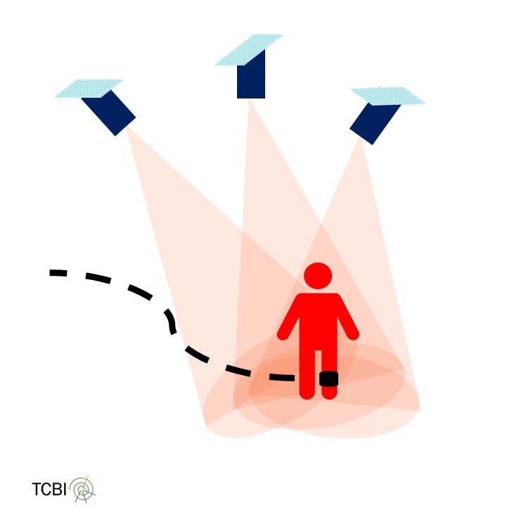 a city map with reasonable accuracy. GPS tags, also worn around the ankle, use the same technology. By triangulating[1] data from multiple satellites they are able to locate individuals. GPS tags have a number of problems including that they do not work well inside buildings or in built-up areas, do not pinpoint individuals exactly[2] and require regular charging. In the criminal justice context, GPS is used primarily to monitor exclusion and inclusion zones i.e. areas where individuals should not go or areas to which they are confined.
Tags are designed to be difficult, but not impossible, to remove. Breaches occur when individuals break their curfew by leaving the nominated place, enter an exclusion zone or leave an inclusion zone. Tampering or removing tags, tampering with monitoring boxes, failing to charge GPS devices and threats and/or violence against staff all result in breaches.
England and Wales use RF and GPS technologies.[3]
If you have any comments or suggestions, please contact Eszter Párkányi (e.parkanyi[at]leeds.ac.uk).
Last updated: 7/12/2018
[1] The tag communicates with the satellite by checking the timestamps. When the signal of the satellite arrives at the tag, it compares the timestamp on the signal with its own time and uses the difference to calculate the distance to the satellite. The longer it takes for the signal to arrive, the longer the distance. In addition, the tag knows the orbit of the satellites, and by using the distance and the data of orbit, they calculate the area where they are located. By using the data from multiple satellites (3 or 4), they are able to calculate a precise location.
[2] See the presentation of Andy Kemp and associated report.
[3] Hucklesby, A, Holdsworth, E (2016) Electronic Monitoring in England and Wales. EMEU Report